In what year was the city of Kokshetau founded? Kazakhstan, city of Kokshetau: population
The content of this section is not a new historical study of the history of Kokshetau or a detailed presentation of it. The main milestones of the city's development are covered by date. In this case, materials from publications in the press were used (in local newspapers “Stepnoy Mayak”, “Risk Business”, advertising and information directory “Kokshetau”, etc.). Some information and illustrations were taken from the website kokshetau.online.kz. , where newspaper publications about Kokshetau are presented quite fully. Most of the illustrations are taken from the archives of the city newspaper Vesti, published in 1996 and deceased. They were provided to her for publication by the regional history museum.
If any of the readers would like to supplement the pages with some material or correct possible inaccuracies, wishes can be sent by E-mail:
OPENING OF THE KOKCHETAV ORDER
The history of the emergence of the city of Kokchetav is closely connected with the events of the annexation of Kazakhstan to Russia in the middle of the 18th century. From that time on, the construction of fortresses and pickets began on the territory of northern Kazakhstan, which served as outposts for the gradual development of the Kazakh steppe.
In 1822, Emperor Alexander I signed a number of bills, according to which Siberia was divided into two governorates: Western and Eastern. The first included the Tobolsk and Tomsk provinces and the Omsk region. The territory where present-day Kokshetau is located, as part of the Middle Zhuz, became part of the Omsk region, while internal self-government of the Kazakh communities was still preserved.
In accordance with these decisions, on April 29, 1824, on the southern side of the Kokchetav (Borovskie) mountains on the shore of the Kokchetav (Big Chebachye) lake, the Kokchetav district order was opened. Gabaidulla Valikhanov, the eldest son of the last khan of the Middle Zhuz, Vali, was elected chairman (senior sultan). The district included 45,000 indigenous people. All of them were divided into 17 volosts.
This date was legally established by a decree of the Governing Senate and is considered the date of foundation of the city of Kokchetav, although another three years passed before the foundation of the settlement in the place where the city is now located. The local population strongly opposed the new settlement being located in the chosen location. Three years passed in search of a convenient place to settle.
Finally, a convenient place, from a military point of view, was chosen: on one side there are hills, from the heights of which one can survey a significant area, on the other side there is a vast lake, making the fortification built here impregnable. The factor that the nearby hills were covered with timber and firewood was also taken into account, in quantities sufficient to build and develop a large settlement.
Thus, in the summer of 1827, the district order was moved to the foot of the Bukpa hill, where the city is located to this day. The settlement began to be called Kokchetav (in Russian transcription, by the name of the mountains, clearly visible in clear weather, blue in the distance, in Kazakh called Kokshetau - “blue mountain”).
FROM THE FOUNDATION TO THE PRESENT
The settlement of Kokchetav from the moment of its foundation was carried out by settlers from the Chelyabinsk district, Orenburg and Saratov provinces.
The settlers built good quality houses for themselves by cutting down the pine forest adjacent to the lake. But the village under construction did not have the owner’s appearance and was not well-appointed. The buildings were not distinguished by their special architecture, scale or amenities. Log houses were usually built from two rooms with roofs, separated by a dark corridor. Instead of glass, the windows were covered with dressed animal peritoneum or dry films of bovine bladders.
 From the second half of the 19th century. active settlement of Kokchetav begins. In 1863, the population became so large that 72 retail stores, 10 dairy shops, and 11 drinking establishments were already operating in the city to meet its needs. There are two schools - Kazakh and stanitsa.
The village itself grew so much that in 1887 it already had 288 houses and 1819 inhabitants.
Outside the village, the bourgeois part of the city was built. Mostly the poor settled there, consisting of peasant migrants and exiles from the European part of Russia. The border between them was Granichnaya Street (then Kirov Street, now Zarap Temirbekov Street).
Two churches were built, separately in the village and in the bourgeois part. There were also two mosques.
In 1868, a new system of government was introduced, external districts and the power of senior sultans were abolished. The Kokchetav outer district, as a district, became part of the Akmola region with its center in the city of Omsk, and the village of Kokchetavskaya became a district center. The district was governed by the district chief Alexey Ivanovich Tupolev, his deputy was Yakub Valikhanov (brother of Shokan Valikhanov). The village received the status of a city, which became known as Kokchetav.
In 1876, Kokchetav lost its military significance. The line and fortress were abolished, steppe self-government was eliminated. The steppe became an integral part of the Russian Empire and was subject to its laws along with other provinces.
 The buildings in the city were predominantly wooden. There were no hotels or cabs. A hospital with 15 beds was built, staffed by one doctor and a paramedic. In the bourgeois part there were many small enterprises: forges, repair and other handicraft workshops, wind and water mills. The largest enterprises at that time were a tannery (the entire inventory consisted of a large vat and soaking and tanning tubs), a slaughterhouse and a lard furnace. There were several manufacturing shops and shopping arcades for trading small goods. The city came to life during the annual autumn fairs, when merchants from Petropavlovsk, Kurgan, Omsk, Semipalatinsk, Akmola and other places gathered. Rows of booths, yurts, and stalls arose on a vast territory, and thousands of people gathered. Trade items included textiles, haberdashery, timber, household items, furs and other goods.
In 1904, the first brick building was built in the city, owned by the rich man Smurov (now it houses a local history museum). But there were still not enough residents in Kokchetav. In 1912, according to documents from that period, they drank only 6172.6 buckets of wine for the entire year.
In 1910, on the initiative of city resident K.I. Zakharov, the first summer cinema was built from planks.
In 1916, with the construction of iron foundries, a power plant with a capacity of 8 kW per hour was launched.
Further successes in the development of Kokchetav are directly related to the establishment and formation of Soviet power.
After the February Revolution of 1917, the District Executive Committee was organized in the city. At the same time, the Bolsheviks created the Council of Workers' and Soldiers' Deputies, which in December of the same year took power into their own hands.
With the beginning of peaceful life after the bloody civil war, the progressive development of all aspects of city life continued.
In 1919, the People's House opened. A music school with classes for piano, violin and wind instruments was opened at the People's House. The school had 6 teachers and 180 students.
On July 1, 1920, the first issue of the newspaper “Red Plowman” was published, which is considered the ancestor of the newspaper “Stepnoy Mayak” that still exists today.
In 1921, in connection with the formation of the Kazakh Autonomous Soviet Socialist Republic as part of the Russian Federation, Kokchetav as part of the Akmola region was removed from the Omsk province.
In 1923, a Russian pedagogical technical school was organized in Kokchetav, which became a Kazakh pedagogical school in 1928. By 1925, there were already 6 schools operating in the city, one Kazakh and one Tatar. In addition, a Russian seven-year school was opened. All schools already had 1,212 students and 32 teachers.
Since 1919, the health department has been operational.
In March 1920, a local history museum was created in Kokchetav by the department of public education.
 In 1922, the construction of the Petropavlovsk-Kokchetav railway line was completed.
In 1925, there were five libraries in the city, the total collection of which was 12,541 books.
In 1927 the first radio center was installed.
In 1928, the elevator was launched. Later, the woodworking artel “Krasny Lomovik” and the sewing artel “Red Banner” started working.
In 1928, all counties were abolished and districts were introduced in their place. Kokchetav district was divided into several districts. Kokchetav becomes the regional center of the Kokchetav district.
In 1940, the city's population exceeded 19,000 people. Compulsory seven-year education was introduced. The number of schools increased to ten.
During the Great Patriotic War, every fourth citizen went to the front. 29 Kokchetav residents were awarded the title of Hero of the Soviet Union. Six of our fellow countrymen became full holders of the Order of Glory.
In September 1941, a train with evacuated workers and equipment from the Podolsk sewing machine plant arrived in Kokchetav, which was located and launched on the basis of the Mechanical Plant existing in the city and immediately began producing defense products. Since August 1941, evacuation hospital No. 2447 for Red Army soldiers operated in the city. Later, the city also housed special hospital No. 3602 for wounded German prisoners of war.
From February 20, 1932 to June 29, 1936, the city of Kokchetav was part of the Karaganda region as a regional center, and Petropavlovsk was its regional administrative center. From 1936 to 1944, the city of Kokchetav belonged to the North Kazakhstan region.
On March 16, 1944, by the Decree of the Presidium of the Supreme Council of the Kazakh SSR, the Kokchetav region was created and Kokchetav became the regional center.
After the war, the city needed a lot of workers.
In 1949, 26 thousand people lived in the city.
The Mechanical (later Instrument-Making) Plant began to gain strength. At first it produced equipment and products for the clothing industry. Later it was repurposed for the production of weighing products. In the post-war years, a brick factory, a 2-story shoe shop building and other local industrial enterprises were put into operation. But the city was still very small.
The rapid growth of the settlement began in the second half of the 50s. In 1958, a garment factory began operating; in 1959, the Oxygen-Respiratory Equipment Plant came into operation, which for a long time was the largest enterprise in the city with several thousand employees. Since 1954, buses and taxis began operating in the city.
The buildings of a cooperative technical school and many cultural centers were built, and a 3-story regional hospital was built. Multi-storey housing construction began, the first asphalt street appeared (K. Marx Street, now Abay Street). The central square of the city has changed. The building of the House of Soviets was built (now it houses the Ministry of Natural Resources and Environmental Protection). According to the 1959 census, the population of Kokchetav was already 52.9 thousand people. Two regional newspapers are published in the city - in the Kazakh language "Kokshetau Pravdasy", in Russian - "Kokchetavskaya Pravda" (from 1944 to 1956 it was called "Stalin's Banner", in May 1963 it was called "Steppe Lighthouse").
In March 1960, the city of Leningrad took patronage over the Kokchetav region, and its two largest districts - Dzerzhinsky and Kuibyshevsky - took patronage over the city of Kokchetav.
But Kokchetav achieved its greatest development in the 1970-1980s.
All schools existing in the city today were built at this time, and housing construction was proceeding at a rapid pace. The Palace named after V.I. Lenin was built, a new airport that could accommodate large aircraft on its runway, which made it possible to maintain air traffic with the largest cities of the USSR - Moscow, Leningrad, Alma-Ata and many others. New railway and bus station buildings were built.
Kokchetav became a major aviation and railway hub. This was especially noticeable during the summer months. When planning your trips, you had to think about buying tickets 30 days in advance. To become a ticket holder, you had to line up at the box office the evening before the start of ticket sales.
There are several higher educational institutions and branches of research institutes in the city.
In 1977, the population of Kokchetav exceeded the hundred thousand mark.
 In the 80s, the development of the city became especially noticeable. The central part of the city radically changed its appearance. New buildings of high-rise hotels and department stores appeared, and M. Gorky Street was transformed. It was during these years that the Tsentralny and Vasilkovka microdistricts were built. The radio plant began to operate, which in the future was assigned the role of the largest plant not only on the scale of the city, but also of great importance on the scale of the Soviet Union. In 1982, the Vasilkovsky mining and processing plant began operating. In 1984, construction of the porcelain factory was completed. New buildings of the regional hospital have been built and new clinics are opening. Many other enterprises were launched during these years. The cultural life of the city is active. Artists from leading theaters from all over the country often visit the city.
There is a Russian drama theater in the city, and a museum of literature and art is opening.
The population of Kokchetav in the second half of the 80s exceeded 150 thousand people.
After the collapse of the USSR in 1991 and during the years of formation and strengthening of Kazakhstan’s independence and in the process of economic reform, Kokchetav, like many other cities, had to endure some losses. One of the industry's flagships, the Kokchetav Instrument-Making Plant, ceased to exist.
Now there are more than 2 thousand different enterprises of different forms of ownership in the city. Some of them are quite active and have a solid reputation both within the city and outside of Kazakhstan.
The city has a network of private cafes, shops, hairdressers, and branches. There are branches of the largest Kazakhstani banks.
On October 7, 1993, a Resolution of the Presidium of the Supreme Council of the Republic of Kazakhstan was issued on transcribing in Russian the names: Kokchetav region as Kokshetau and the city of Kokchetav as Kokshetau.
In 1995, the Museum of Hero of the Soviet Union Malik Gabdullin opened.
In 1996, the Kazakh Music and Drama Theater named after. Sh. Kusainova.
In June 1996, on the basis of three universities - pedagogical, agricultural and polytechnic, a university was opened, which bears the name of our fellow countryman, encyclopedist scientist Sh. Ualikhanov.
In the spring of 1997, by decision of the government, the Kokshetau region was abolished. Kokshetau ceased to be a regional center. According to the census conducted in March 1999, the city's population was 132.9 thousand people.
On April 8, 1999, after changing the administrative structure of the Akmola and North Kazakhstan regions, Kokshetau again became the regional center of the changed Akmola region.
|
Kokshetau University named after. Sh. Ualikhanov
Main square of the city
Hotel
Monument to Abylai Khan
KazPost building
Half granite ball
Date of publication: 06/08/10
Oddly enough, I liked it. A standard Soviet city is shown simply but well.
Yes, there was a whiff of something old, Soviet - nostalgia. Probably, the city in Russia used to be called Kokchetav?
Liked! Everything is good, neat and clean. The city is still called Kokchetav in Russia. It was founded by Russian Cossacks, so why break the tongue?
AK1981 You should create films in Hollywood, auntie has a good imagination, made me laugh))) For your information, Kokshetau - translated means “green mountains”
Kokshetau is the real name of the city, but it is difficult for Russians to pronounce this name, so they changed it in their own way (Kokchetav). Kokshetau can also be translated from Kazakh as Sinegorye.
Bake, I’m not going to make films in Hollywood and I’m not going to argue with you either. Get acquainted with the history of this city and Kazakhstan. Look at maps of the 19th century, they are on the Internet.
Let's not argue about the pronunciation of names. Here are some examples: in Russian - Moscow, and in English - Moscow, in Russian - Paris, and in French - Paris. In Russian Beijing, in Chinese Bijing. Very well.
The ending “tau” “tai” “tey” (mountains) is generally found in Turkic names. In addition, in a heated imagination the following series appears: tau (Turk.), tyn (Slav.), town (German) - mountains, hedge, fence, i.e. sometimes distorted and genuine names shimmer quite organically.
Kokshetau is a Cyrillic transcription of the Kazakh pronunciation of the name.
AK1981, on the territory of modern Kokshetau the indigenous inhabitants were Kazakhs and Tatars. It was after that Russians began to move in from neighboring provinces. Unlike you, I know the history of Kazakhstan better. Well, I looked at a map of the 18th-19th century, well, the cities of Orenburg, Saratov, Omsk, Astrakhan were part of (in the territory of) Kazakhstan, so what? And there is no need to teach us how to pronounce Kokshetau correctly, I don’t care how they pronounce it in Russia or America, Kokchetav or Kokchetavsk, Kakchetau or Kokchataupolis. The original name is Kokshetau and there is no need to argue here.
P.S. I didn’t want to offend anyone and in general I don’t like these political disputes, it’s just that some smart people start writing whatever comes into their head...
Wikipedia: Founded in 1824 as a military fortification of Kokchetav. Initially it was a village, and since 1868 it has been a district center. On March 16, 1944, by the Decree of the Presidium of the Supreme Council of the Kazakh SSR, the Kokchetav region was created and Kokchetav became the regional center.
On October 7, 1993, by the Resolution of the Presidium of the Supreme Council of the Republic of Kazakhstan, the city of Kokchetav was renamed Kokshetau. In the spring of 1997, the Kokshetau region was abolished, Kokshetau ceased to be a regional center. On April 8, 1999, after changing the administrative structure of the Akmola and North Kazakhstan regions, Kokshetau became the regional center of the Akmola region, which was changed within the boundaries.
Elena. Shustrova, thank you! You're right! Just a small addition: the question was: “why break your tongue?” those. Was it not because of consonance and not “in vain” that they gave the “new” name? The answer, apparently, may be this: the Russian Cossacks who founded the city initially assigned it a distorted (in consonance with the Kazakh) name. The name Kokchetav as part of the Russian language. and without connection with Kazakh, apparently, it is meaningless. Even “tov” in Russian can hardly be placed in a row with “tau” (mountains) or “town” (city): Saratov is not Sara-gorod, but Sarat-ov (i.e., it answers the question “whose”? ) For comparison - the village of Sarat (Omsk Region). However, I am not an expert on the topic, only a teacher. language Being initially an official, albeit distorted name, “Kokchetav” has or had a “legal” right to exist only due to historical tradition. However, it is hardly worthwhile - and especially now - to demand from the Kazakhs that they call their city a distorted derivative of the Kazakh language.
I absolutely agree with you, juodasis_kelias. But you shouldn’t force Russian residents to pronounce the Kazakh name if there is a traditional Russian one.
Bake, I really didn’t want to get into an argument with you, but the original name of the city is KOKCHETAV (certainly a transformed Kazakh name of the area).
In 1822, Emperor Alexander I signed a number of bills, according to which on April 29, 1824, the Kokchetav district order was opened on the southern side of the Borovsky Mountains on the shore of Lake Bolshoye Chebachye. To get acquainted with this document, you can contact the Russian State Archive of Ancient Acts.
Azamat Rakhimzhanov. The Kazakhs most likely renamed it in their own way. the city of Kokchetav was founded in 1824 as a military fortification of Kokchetav. And already in October 1993, by the Decree of the Presidium of the Supreme Council of the Republic of Kazakhstan, the city of Kokchetav was renamed the city of Kokshetau. So Mr. Rakhimzhanov needs to know the history of his city.
Bake. Dear, the city of Kokchetav was founded as a military fortification, mainly Russians lived there. And after the collapse of the USSR, Kazakhs began to move to the city of Kokchetav from the villages, where complete devastation reigned and still reigns.
))) I know how history was written under Sovka, especially under Tsarist Russia. Take the Second World War, for example, only last year it was recognized that the banner at the Reichstag was hoisted by Lieutenant Rakhimzhan Koshkarbaev and private reconnaissance officer Grigory Bulatov. And there are many such examples, so dear CLEAN you need to read a reliable story
CLEAN: Kokshetau - the area where the city is located was named after the name of the area, reinterpreted in their own way by Russian settlers and named this fortification. I’m not saying that the Kazakhs built a city and called it Kokshetau, why did they need a city on pastures...
Yes, from the moment the decree on the construction of the city was signed to the actual start of construction, 4 years passed, if I’m not mistaken. The local population was against construction on their pastures.
Bake, they talked about Lieutenant Koshkarbaev and Private Bulatov before; there were several flags like theirs installed at the Reichstag. Koshkarbaev crawled up on his belly and placed a red flag on the stairs when the building itself was still occupied by the Nazis. But the banner specially made for this purpose on the dome of the Reichstag was still hoisted by Kantaria and Egorov.
Bake, what does the Reichstag banner have to do with this, we are talking about the formation of a city. Also, give an example about aliens coming from Mars
Azamat Rakhimzhanov,)))) let the area be called the Golden Horde, we are talking about the name of the city that was given to it at the founding. Also say that the city of Verny (now Alma-ata) was previously a place called Almaty))))
We are still talking about the name of the city on this Russian-language site. The point of discussion could be understood in different ways; but only this last point remains.
CLEAN, I’m not talking about the banner over the Reichstag (this is just an example), but about history, which is rewritten by each country in its own way.
AK1981 Well, we covered this story differently, the banner was hoisted ABOVE the Reichstag, and not on the stairs. And when asked by the public why this fact was hidden for more than 60 years, no one answered.
Dear AK1981 and CLEAN, I think that this is not the way to end this political debate. This discussion will lead nowhere, because... you will still remain with yours, and I will remain with mine. Sincerely.
Nowadays, history is distorted however they want! Therefore, they cannot answer specific questions. If we judge this way, then other people can also apply for raising the Victory Banner.
I wonder if the Russians took the name Kokchetav from the ceiling when building the fortification? They used the Kazakh Kokshetau (Blue Mountains) and translated the traditional name of the area into Russian transcription. Naturally, on maps compiled by Russian cartographers there is a Russified name. And about the fact that mostly Russians lived there... Do you know why? When the Russian Empire fortified its borders with fortresses, it populated these lands with imported Cossacks, workers (in the east and west of Kazakhstan, where raw materials for the empire were mined in mines) and their families. The local population, that is, the Kazakhs, were expelled from the lands. This is the first. And secondly, in the 50s of the 20th century, the Soviet government began to develop the virgin lands of Kazakhstan. Please note that I am not in the least belittling the importance of their work. Many, many virgin lands remained here. And even before that there was a forced resettlement of unreliable peoples, in the opinion of the communists, to our republic. I still remember our German neighbors with love, and we were also friends with Ukrainians, Chechens, Poles, Tatars, and Koreans. But this land was not their original homeland, nor was it for the Russians. My parents, my parents’ parents, lived here. I am grateful that cities grew up in our steppe, so different and beautiful, my beloved Kokshetau and Karaganda, Almaty and Aktobe. But don’t bring a blizzard in the style of Vladimir Volfovich, gentlemen, history experts.
Yes, no one argues that the indigenous inhabitants of these lands are Kazakhs. Do not worry.
AK1981 +100))) Don’t pay attention to anyone; complexes torment people, apparently, and this is where nationalism begins. scrapes and Russophobia, accompanied by a reversal of history. Apparently our Ivan is to blame - he’s too kind. If they were like many indigenous residents of the former republics of the USSR describe, they would have long ago lived on reservations like Indians in the USA (by the way, also indigenous people), or they would have assimilated. But Rommia is kind - she will teach everyone, build infrastructure, protect, etc. They do not seek good from good.
sorry for typos)
Register or log in to comment.
On the site of the modern small town of Kokshetau at the beginning of the 19th century. there was a Cossack settlement. Today the city has the status of the administrative center of the Akmola region, has a developed industry, and new microdistricts are being built. The satellite map of Kokshetau shows that the city has grown on the shores of Lake Kopa. From the south and west, the city outskirts are limited by mountains and hills. The Kilshakty River flows within the boundaries of the settlement; there are no other significant hydrographic objects.
The peak of city construction on the site of a small settlement came in the post-war years, when the country needed to revive and ruin industry. All factories, factories, streets, residential areas, administrative buildings and parks can be found on the map of Kokshetau with diagrams.
Kokshetau received city status only in 1991. At that time, it already had a developed infrastructure, educational institutions, hospitals and several large industrial enterprises, the oldest of which is considered to be KokshetauMinVody. Most of the industrial enterprises, as the map of Kokshetau by district shows, are located in the northern part of the city.
Map of Kokshetau with streets
The longest transport route in the city is Ualikhanov Street, and the busiest in terms of transport is Abylay Khan Avenue. The streets of the city are rectangular and parallel and form residential areas.
On the map of Kokshetau with streets you can see that several main transport routes pass through the central part:
- Gorky;
- Mukhtar Auezov;
- Abaya;
- Pushkin;
- Kuanysheva.
A railway runs along the eastern outskirts. The passenger train station is located in the center. The international highway R-12 runs through the city from northeast to southwest. But most of the transit transport goes around the city along a bypass road through the village of Ivanovka and the southern outskirts.
Intercity passenger traffic is carried out from the platforms of the only bus station in the city, which, as the map of Kokshetau with streets and houses shows, is located near the railway station at the end of Abay Street.
The P-14 highway passes by the Kokshetau airport, which is located in the northeast in the suburbs. The city’s “air gate” accepts international and domestic flights, and also has landing strips for military air transport.
Map of Kokshetau with houses
The housing development of old microdistricts is typical for cities built during the Soviet years. Despite the fact that Kokshetau is currently being actively built up with new, modern, beautiful buildings, more of them are “growing up” in areas remote from the center.
In the central part, former merchant stone and wooden houses peacefully coexist with “khushchevkas” and standard administrative buildings. In the area of the main streets of the city on the map of Kokshetau with houses you can find:
- regional Akimat;
- city Akimat;
- mosque;
- National Bank;
- Kazakh drama theater;
- Justice Department;
- hotels;
- shopping centers.
The city has several beaches on the shores of Lake Kopa, as well as a large number of parks and squares where local residents like to relax:
- Tauelsyzdyk Square;
- Abylai Khan Square;
- Apple orchard;
- Park in Memory of Internationalist Soldiers.
On the map of Kokshetau with house numbers you can find any object, be it a residential building or an administrative institution.
This service allows those who come here for the first time to quickly navigate the location of city infrastructure facilities. It may be useful to students who will find universities on the map such as:
- Academy "Kokshe";
- State University named after Shokana Ualikhanov;
- Cossack-Turkish Lyceum for gifted children and adolescents;
- Academy of Economics and Management.
Also in the city there is a military technical school and a medical school, which are located in the center on a detailed map of Kokshetau.
Economy and industry of Kokshetau
The largest in terms of production volumes, as well as the oldest enterprise in Kokshetau, is the KokshetauMinVody plant. It was built in the post-war years to bottle mineral water, but today, in addition to these products, it also produces alcoholic and non-alcoholic drinks. Yandex maps of Kokshetau will help you find this and other city enterprises.
Kokshetau factories also produce:
- KAMAZ trucks;
- spare parts for cars;
- components and assemblies of aviation equipment;
- medical and pharmaceutical scales;
- fire extinguishing devices;
- fittings;
- polypropylene pipes.
Food factories supply the city and region with sausages, semi-finished meat products, bread, dairy products, and confectionery. The city also has a gold extraction factory and a new factory for the production of ceramic bricks.
Kokshetau is located in the northern part of Kazakhstan, approximately 300 km north of Astana, on the Kokshetau Upland, near Lake Kopa.
Kokshetau is the administrative center of the Akmola region in the Republic of Kazakhstan.
Until October 7, 1993, in Russian transcription the city of Kokshetau sounded like Kokshetau, however, after gaining independence, the government of Kazakhstan adopted a Resolution on transcribing in Russian the names “Kokshetav” region as “Kokshetau”, and the city “Kokshetav” as “Kokshetau”.
The history of the emergence of the city of Kokchetav is closely connected with the events of the annexation of Kazakhstan to Russia in the middle of the 18th century. From that time on, the construction of fortresses and pickets began on the territory of northern Kazakhstan, which served as outposts for the gradual development of the Kazakh steppe.
Kokshetau will surprise tourists with its neatness and beauty and the friendliness of the locals.
Sights of Kokshetau
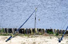
The main attraction of Kokshetau is the State National Natural Park "Burabai". And its decoration is 14 excellent lakes among picturesque mountains covered with dense coniferous forests. Lake Borovoye is considered the most significant among them in terms of size, beauty and love of tourists.
The lake is located 70 km from the city. Numerous hotels, sanatoriums and holiday homes have been built on the shores of the lake. The mild mountain climate, clean air and the presence of healing mud make holidays here not only pleasant, but also therapeutic.
Another local national park is the Kokshetau Nature Park, formed in 1996. It is located 60 km southwest of the city. Within the park, mountain forest and steppe natural zones and the water world of lakes Zerenda, Shalkara, Imantau and Saumalkol are protected. There are many hiking and horse riding routes in the park. In addition, there is the opportunity to temporarily settle in one of the traditional Kazakh villages.
Officially considered the administrative center of the Akmola region. We will tell you in this article how the number of residents in this locality changed.
City `s history
The population of Kokshetau is now very large. Never before in the history of the city have so many people lived here. The city was originally founded by Mikhail Kazachinin in 1824. The founder of the city graduated from the Cossack military school in Omsk, and arrived on the territory of modern Kazakhstan to create the military fortification of Kokchetav. In the first years of its existence, Kokshetau was considered a Cossack village.
In the 19th century, the city began to develop quite quickly. In 1824, it was officially recognized as the center of the outer district of the Omsk region. Another 30 years later, the center of the Siberian Kirghiz region settled here, and since 1868 Kokshetau has become the district center of the Akmola region.
The situation changes radically after the October Revolution. When Soviet power was established in the district, the city was included in the Omsk province. This happened in 1919, since then it has been considered its county center.
Kokshetau in the 20th century
At the end of the Great Patriotic War, in 1944, the Kokchetav region was formed by decree, and the city of Kokchetav became the regional capital for quite a long time.
Kokshetau received its current name only after the collapse of the Soviet Union, when it officially left the USSR and now became part of the territory of Kazakhstan. By a resolution of the Supreme Council of the Republic in 1993, the city was given a modern name, now familiar to all of us.
It was decided to abolish the Kokshetau region in 1997. After this, the city itself automatically lost its honorary status as a regional center.
In 1999, administrative changes in the structure of the North Kazakhstan and Akmola regions came into force. After this, Kokshetau became a city of regional significance, the capital. Regional status again returned to the populated area.
Location of the village

The city of Kokshetau is located on the very shore of Lake Kopana, which is located in the northern part of the Kokshetau Upland. Its foothills surround the city immediately on the western and southern sides.
The total area of the settlement is about 400 km 2 . Traditionally, this includes the village administration of the Station and Krasnoyarsk rural district. The latter includes two more settlements of rural subordination - Kyzylzhulduz and Krasny Yar.
Population

The first data on the population of Kokshetau dates back to 1897, by which time the city had existed for more than 70 years. Almost 5,000 inhabitants lived in Kokshetau at that time.
The following data, which can be trusted, relates to the post-war history of the city, when it was already part of the Soviet Union for several decades. In particular, the population of the city of Kokshetau in 1959 was almost 53,000 people.
Under Soviet rule, there was a constant positive trend in the increase in the number of residents in the city. The population of Kokshetau increased, reaching 80,500 people by 1970. And in 1989, more than 103,000 local residents already lived here.
In the year of the collapse of the Soviet Union (1991), the population of Kokshetau was 143,300 inhabitants.
Dynamics in recent years

After the city was deprived of the status of a regional center, the population of Kokshetau decreased, some residents decided to leave for more promising areas of Kazakhstan. So, in 1999, there were just over 123,000 residents left here.
In the 2000s, positive demographic dynamics developed at a slow pace, but the population of the city of Kokshetau in Kazakhstan was growing. By 2008, more than 130,000 residents had already settled here.
Such positive dynamics have continued to this day. What is the population of the city of Kokshetau in Kazakhstan now? According to the latest data, this is 145,762 people.
As Kokshetau authorities note, the city’s population has recently been growing due to migration. The number of marriages is increasing, for example, from 2001 to 2007 it doubled, which has a beneficial effect on the growth of the birth rate. Thus, the natural population increase per year has increased from 183 people in the early 2000s to more than 1,000 people today.
Until 2001, the migration balance was invariably negative, but subsequently the situation changed radically. In particular, the number of people leaving for Russia and countries far and near abroad has decreased.
Thus, among the main factors of population growth is the increase in the birth rate, which was a consequence of a large number of marriages, and the migration influx from other regions of Kazakhstan is also growing. Factors of population decline include mortality and the outflow of residents to the countries of the former Soviet Union and non-CIS countries. The last two indicators, although declining, still remain quite high - more than 8,000 people per year.
It is noteworthy that the ethnic specificity of the birth rate is especially high. Most babies born in Kokshetau are Kazakhs. The high mortality rate among the non-Kazakh ethnic group and mass migration abroad are due to the fact that among non-Kazakh ethnic groups there is a high proportion of the population of older age, and there are practically no young people here. That is why the birth rate among them is so low.
The language environment in the city, which used to be predominantly Russian-speaking, is also changing. Now she is becoming bilingual. It is noteworthy that Kokshetau remains today the only regional center in Northern Kazakhstan in which Kazakhs make up the majority of residents. Now you know how much population there is in Kokshetau and how demographic and migration processes are formed in this city.
National composition

As of 2018, the majority of residents of Kokshetau are Kazakhs. There are more than 90,000 of them here, which is 57% of the total number of residents. Second place in this ranking is occupied by Russians - almost 48,000 of our compatriots live here on a permanent basis. This is almost 30% of the total number of residents.
As you can see, the national composition of the population of Kokshetau can be described as mixed. The influence of the Russian diaspora is quite strong and very noticeable.
Among representatives of other nationalities, it is necessary to highlight Ukrainians (almost 3%), more than 2% of residents are Tatars, more than 1% of Kokshetau residents are Germans, Poles, Ingush. Less than 1% of the city's residents are diasporas of Belarusians, Koreans, Azerbaijanis, Armenians, Bashkirs, Moldovans, Mari, Chechens, Udmurts and Mordovians.
The level of education

If in previous years teaching in most educational institutions was conducted exclusively in Russian, recently the situation has begun to change. In Kokshetau, the majority of the population are Kazakhs, so a bilingual environment is increasingly being formed and developed. Now, as a rule, it is possible to receive education in both Russian and Kazakh languages.
The largest educational institution of higher education in the city is Kokshetau State University, which bears the name of Shokan Ualikhanov. This is a famous historian, scientist, ethnographer and traveler who lived in the 19th century. The university was founded in 1996 as a result of the merger of the Pedagogical and Agricultural Institutes, and a branch of the Karaganda Polytechnic Institute also joined them.
Those wishing to obtain higher education in Kokshetau can also apply to the Humanitarian and Technical Academy (as the former Institute of Management and Economics is now called), as well as to the Kokshe Academy (this is the former Kokshetau University) and the University named after Abay Myrzakhmetov, perhaps the youngest institution of higher education education, founded in the city only in 2000.
In the middle level, against the backdrop of a large number of secondary schools, a specialized boarding school stands out, which positions itself as an educational institution for gifted children. In recent years, this boarding school has been officially called the Kazakh-Turkish Lyceum.
Climate
The climate in the city can be classified as sharply continental. The average annual temperature is +3 degrees, frosty and little snow in winter, and dry and hot in summer.
The absolute temperature maximum is recorded in July and August, when the thermometer shows above 41 degrees, the absolute minimum occurs in February, when frosts reach -48 degrees in Kokshetau.
At the same time, the average temperature in summer is about 20 degrees, and in winter about -15.
Economy

The basis of Kokshetau's economy is large industrial enterprises. For example, Kokshetauminvody, which produces alcoholic beverages, as well as mineral water and soft drinks.
KAMAZ vehicles are assembled at KAMAZ-Engineering JSC, a gold extraction factory operates at the Altyn Tau Kokshetau enterprise, and the Enki company is implementing a large-scale project to build a modern plant that will produce up to 50 million pieces of ceramic bricks per year.
Since relatively recently (since 2015), the Bizhan workshop has been producing its own sausage products in Kokshetau.
These companies form the backbone of the city's economy.