Great Britain is washed by the Atlantic Ocean. Area of Great Britain in sq km
Great Britain, which is surrounded on all sides by sea and ocean, still jealously guards its traditions and customs, which may seem eccentric to many foreigners. However, it is precisely this careful attitude to traditions that has made Great Britain one of the most famous and influential countries in the world, which also has amazing nature and even seaside resorts. At the same time, Foggy Albion still remains a mystery to many of us...
Geography
Great Britain is located in northwestern Europe in the British Isles. In the north, Great Britain borders on Ireland; in the southeast, the English Channel (“English Channel”), whose width is 35 km, separates this country from France. The total area of Great Britain is 244,820 km. sq. The country is washed by the Atlantic Ocean as well as the North Sea. The highest peak in Great Britain is Mount Ben Nevis in Scotland (its height is 1343 meters).
The capital of Great Britain
The capital of Great Britain is London, whose population now numbers more than 8.2 million people. London was founded by the Romans in 43 AD.
Official language
The official language of Great Britain is English, which is spoken by more than 95% of the population. Minority languages include Scottish, Welsh, Irish, Gaelic and Cornish.
Religion
The state religion in Great Britain is the Anglican Christian Church, formed in 1534 under the influence of Protestantism. More than 10% of the UK population belongs to the Roman Catholic Church. In addition, there are many Presbyterians and Muslims in the country.
UK government
Great Britain has been a constitutional monarchy for many centuries. The country consists of four provinces - England, Scotland, Wales and Northern Ireland.
The head of state is the Queen, power is inherited. The head of government is the Prime Minister (he becomes the leader of the majority party in the House of Commons).
Legislative power belongs to the bicameral Parliament, which consists of the House of Lords (1200 seats) and the House of Commons (659 seats). The main political parties are the Conservative Party, the Labor Party and the Liberal Democrats.
Climate and weather
The climate in Great Britain is temperate maritime with high rainfall. The determining influence on the climate of Great Britain is the Atlantic Ocean, the North Sea and the Gulf Stream. The average temperature in winter is 0C, and in summer – +25C. The warmest months are July and August, and the coldest is February.
Note that although July and August are considered the warmest months in the UK, they are also the wettest, with the most rainfall.
Seas and oceans in Great Britain
Great Britain is washed by the waters of the Atlantic Ocean and the North Sea. The total coastline is 12,429 km. The English Crown Lands include the islands of Jersey and Guernsey in the English Channel, as well as the Isle of Man (located in the Irish Sea).
Rivers and lakes
There are over 20 large rivers and over 380 lakes (many of them artificial) in the UK. The largest rivers are the Severn (354 km), Thames (346 km), Trent (297 km), Great Ouse (230 km), Wye (215 km) and Tay (188 km).
Note that in Great Britain there is an extensive network of canals, most of which were built in the Victorian era.
British history
Archaeologists have found evidence that people lived on the territory of modern Britain back in the Neolithic era. Many historical artifacts dating back to the Bronze Age have also been found.
In 43 AD Britain, after stubborn resistance from local tribes, was captured by the Roman Empire and became its province. The power of Ancient Rome over Britain lasted until 410 AD, after which the island was alternately invaded by tribes of Angles and Saxons from Germany, and then by Vikings from Scandinavia. The spread of Christianity in the British Isles began at the end of the 6th century.
In 1066, the famous Battle of Hastings took place, consolidating the Norman victory in the conquest of Britain. William of Normandy (better known as William the Conqueror) became king of England on December 25, 1066.
In the Middle Ages, on the territory of modern Great Britain, numerous wars took place between the English, Scots, Irish and Welsh. In 1337, England began the Hundred Years' War against France over the French provinces of Guienne, Normandy and Anjou, which eventually ended in French victory in 1453.
Immediately after this, in 1455, a bloody internecine 30-year War of the Roses began in England between two branches of the royal seven (Yorks and Lancasters).
In 1534, King Henry III became head of the Church of England, which led to the English Reformation and the dissolution of many monasteries. The mid-17th century was marked by the overthrow of the monarchy, the reign of Oliver Cromwell, and then the restoration of monarchical power.
In 1707, England and Scotland signed an act of union, thus forming the Kingdom of Great Britain.
In the 18th century, Great Britain became the largest colonial power with a huge fleet. Trade and banking developed rapidly in the country. At this time, revolutionary changes took place in English industry and agriculture.
The development of Great Britain continued in the 19th century, during the so-called “Victorian era.”
Great Britain played a big role during the world wars of the 20th century. In 1921, the Irish Rebellion broke out, leading to the formation of an independent Ireland. As for Northern Ireland, it is still part of Great Britain. Now Great Britain is an active member of the NATO military bloc and is also part of the EU.
Culture
Since Great Britain consists of several “provinces” (England, Scotland, Wales and, of course, Northern Ireland), which were previously independent countries, it is clear that its culture is multi-ethnic.
Traditional English folk legends about the semi-mystical King Arthur and his knights, as well as semi-historical legends about Robin Hood, are known all over the world. Many historians claim that such personalities really existed in Medieval England, but we know about them only from folk legends.
In general, it should be noted that in Great Britain traditions play a greater role than in many other countries of the world. Residents of Foggy Albion are proud of their traditions, many of which seem strange and eccentric to us. Thus, in Great Britain, theaters have been closed on Sundays for more than 300 years.
Another English tradition is that, according to the decree of King Charles II, 6 crows must permanently live in the Tower of London. The British are confident that as long as these birds live there, nothing threatens the royal power.
Some of you may know that in the House of Lords of the British Parliament the Chancellor sits on a sack of wool. This custom dates back to the times when sheep's wool made England a rich and powerful country.
Old English, Scottish, Welsh and Irish traditions may seem strange to modern Europeans, Asians or Americans, but the inhabitants of Foggy Albion adhere to them with enviable tenacity.
The Canterbury Tales by the English poet Geoffrey Chaucer, published in 1476, had a decisive influence on the development of literature in Great Britain. In the Middle Ages, England gave the world such talented poets, writers and playwrights as Christopher Marlowe, Thomas Wyatt, John Milton and, of course, William Shakespeare.
Subsequently, Jane Austen, Mary Shelley, John Keats, William Blake, George Byron, Charles Dickens, Oscar Wilde, Thomas Hardy, Virginia Woolf, Wodehouse, Eliot, Graham Greene, Iris Murdoch and Iain Banks appeared.
However, Scotland, Wales and Northern Ireland can also boast “big” literary names. The most famous of them, perhaps, are the Scottish poets William Dunbar and Robert Burns.
The most famous artists in Great Britain are George Gower, Samuel Cooper, Joshua Reynolds, George Stubbs, John Constable, Joseph William Turner and David Hockney.
If we talk about music, then, of course, in the UK there were quite talented classical composers, however, this country, first of all, gave the world the legendary “Liverpool Four” - the rock group “The Beatles”.
UK cuisine
Each region of Great Britain (England, Scotland, Wales and Northern Ireland) has its own traditional cuisine. In general, it can be said that British food is based on meat (beef, lamb, pork, chicken), fish, eggs and flour. Meat and fish are usually served with potatoes or some other vegetable.
English cuisine has traditionally been "bland", with no seasoning. However, after Great Britain captured numerous colonies (we are, of course, talking about India), various Indian seasonings began to be used more in English cuisine.
Traditional English dishes - Yorkshire pudding, Christmas pudding, roast beef, Cornish paste, pudding and Battenberg cake.
Traditional Scottish dishes include haggis, oatmeal, pickled herring and Cranachan dessert.
Traditional Welsh dishes include bara brith yeast bread, sorrel soup, beef in beer and Welsh flatbreads.
Traditional Irish dishes include Irish stew, coddle (sausage, bacon, potatoes and onions), barmbrack and potato pancakes called boxties.
We advise tourists in the UK to try the famous English cheeses. In general, more than 400 varieties of cheese are now produced in England. The most popular of these is cheddar (a hard cheese with a strong nutty flavor). In addition, we note such varieties of English cheese as Stilton, Red Leicester and Cheshire.
Traditional British drinks are beer, cider, tea, gin and Pimm (made from gin with the addition of lemonade, fruit and mint).
Sights of Great Britain
There are so many attractions in the UK that we will highlight only the 10 most interesting of them (in our opinion):

Cities and resorts
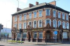
The largest cities in Great Britain are London (more than 8.2 million people), Birmingham (more than 1.1 million people), Glasgow (about 600 thousand people), Belfast (more than 600 thousand people), Manchester (more than 500 thousand . people), Edinburgh (more than 500 thousand people) and Liverpool (about 500 thousand people).
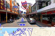
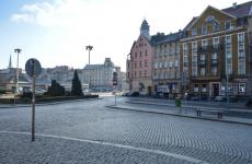
Most of us associate Great Britain with constant rain and fog. However, this country turns out to have excellent seaside resorts. Moreover, the UK even has the English Riviera (Torbay). The most famous seaside resorts of Foggy Albion are Newport, Eastbourne and Brighton. There are approximately 760 beaches in the UK that are tested annually to meet European standards.
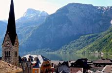
We also note that there are many balneological resorts in the UK, among which the most popular are Bath, Leamington, Builth, Harrogate Llandrindod, Buxton and Llanurtyd. By the way, the resort of Bath is included in the UNESCO World Heritage Site, because... It has the best preserved Roman baths, created during the reign of Ancient Rome.
Souvenirs/shopping
In Great Britain, tourists will be offered a huge number of different souvenirs. Traditional ones include tea, T-shirts, balls, dishes, handicrafts, and toys. We advise tourists visiting Scotland to bring home traditional Scottish macaroons, Glenfiddich single malt whiskey and a kilt.
Office hours
In the UK, most shops are open on weekdays from 9.00 to 18.00, and banks - from 09.30 to 16.30.
Pub opening hours:
Mon-Fri: from 11:00 to 23:00, although many now prefer to work later.
Visa
The United Kingdom of Great Britain and Northern Ireland or Great Britain is a sovereign state located off the north-eastern coast of continental Europe. It occupies the island of Great Britain (England, Scotland and Wales), one sixth of the island of Ireland (Northern Ireland), as well as many nearby small islands. The main territory of the country is located between 49°N. and 59°N. (Shetland Islands are located near 61°N latitude) and 8°W longitude. and 2°E. Greenwich Observatory, located in southeast London, is the origin of geographic longitude; the prime meridian passes through it.
Great Britain is washed by the waters of the Atlantic Ocean and the North Sea. The minimum distance to Europe is 35 km. The country is separated from France by the English Channel and Pas de Calais. Northern Ireland has a 360 km land border with the Republic of Ireland. A tunnel has been built between the UK and France under the Pas de Calais Strait. Great Britain, which includes the island of Great Britain, the north-eastern part of the island of Ireland and a number of nearby small islands, has an area of 243,610 square meters. km. The area of England, the largest country within Great Britain, is 130,410 square meters. km, the area of Scotland is 78,772 sq. km. Wales and Northern Ireland are significantly smaller in area - 20,758 sq. km and 13,843 sq. km respectively.
Relief of Great Britain
Based on the relief features, the territory of the United Kingdom can be divided into two main areas. The Highlands of Britain (including Northern Ireland), located in the north and west of the country, are underlain by resistant ancient bedrock and consist mostly of highly dissected uplands and much less widespread lowlands. To the south and east lies Low Britain, characterized by rolling terrain, low elevations and several mountainous areas; younger sedimentary rocks lie at its base. In a south-west direction from Newcastle at the mouth of the Tyne River to Exeter at the mouth of the Exe River in south Devon there is a border between High and Low Britain. This boundary is not always clearly defined, and often the transitions between High and Low Britain are smoothed out.
At the base of the mountains throughout Scotland, Northern Ireland and Wales lie Lower Paleozoic folded structures, and in southern Wales and southern Cornwall - Hercynian ones. These ancient mountain structures were subjected to intense erosion and destruction for a long time, which led to the leveling of their surface.
As a result of recent uplifts, which occurred in several stages and were accompanied by discontinuous movements, the mountains were fragmented into a number of massifs and acquired a mosaic structure. Leveled surfaces of different heights are very characteristic. The tops of mountains often have a flattened shape. The UK's mountains are relatively easy to access, with numerous roads along low watersheds and wide passes.
UK statistics
(as of 2012)
Quaternary glaciation intensified the smoothing of the mountains, as a result, in the most elevated areas, an alpine-type relief with sharp jagged ridges and peaks, glacial cirques and typical valleys was formed. Erosion processes, which are actively occurring at the present time, played a significant role in modeling the relief. In many lowland areas, erosion has severely, and in some places completely, erased glacial-accumulative landforms formed during the era when ice sheets descended from the mountains to the plains. It is known that, for example, during the maximum glaciation, ice approached the Thames Valley, but the extreme south of England was never covered with ice.
UK climate
The climate of Great Britain, due to the influence of the Gulf Stream, is temperate oceanic, humid, with mild winters and cool summers, strong winds and fogs. Thanks to the North Atlantic Current and warm winds blowing in from the Atlantic Ocean, the UK tends to have mild winters.
But these same winds explain cloudy weather, frequent rain and fog. The average annual temperature is about 11°C in the south and about 9°C in the northeast. The average July temperature in London is about 18°C, the average January temperature is about 4.5°C. The average annual precipitation (the heaviest rain occurs in October) is about 760 mm. The coldest region in the UK is Scotland, although the climate there is generally quite mild. The average January temperature is about 3°C, and snow often falls in the mountains in the north. The average July temperature is about 15° C. The greatest amount of precipitation falls in the west of the Highlands region (about 3810 mm per year), the least in some eastern regions (about 635 mm per year).
The climate of Wales, like that of England, is mild and humid. The average January temperature is about 5.5°C. The average July temperature is about 15.5°C. The average annual precipitation is approximately 762 mm in the central coastal region and more than 2540 mm in the Snowdon massif. Northern Ireland has a mild and humid climate. The average annual temperature is about 10°C (about 14.5°C in July and about 4.5°C in January). Precipitation in the north often exceeds 1016 mm per year, while in the south it is about 760 mm per year.
The main reasons for the increased rainfall in the UK are the presence of an area of low pressure that extends across the Atlantic Ocean to the east; southwesterly winds prevailing throughout the year; and the fact that most of the mountains are in the west of the country. Frosty weather sets in for a long time with the invasion of cold air from the east and northeast.
Snow falls throughout the country, but very unevenly. In the mountainous regions of Scotland, snow cover lasts for at least 1-1.5 months. In the south of England and, especially in its southwest, snow falls very rarely and lasts no more than a week. Here the grass is green all year round. The west of Britain typically receives twice as much rainfall in winter as in summer. In the eastern regions, winter is colder and less humid.
The weather in the British Isles has become notoriously variable and treacherous due to these climatic conditions. At these latitudes, summer days are long and winter days are very short. Even on the long days of July, the southern coast receives only seven hours of sunshine on average, while the northern part of the country receives less than five hours a day. The lack of sunlight is due to increased cloud cover, and not due to fog, as is commonly believed. London's famous fogs in the past were due to thick smoke from burning coal for heating purposes, rather than due to meteorological conditions. However, damp, damp fog still occurs in London on average 45 days a year, predominantly in January and February, and most ports experience between 15 and 30 foggy days each year, with fog able to paralyze all traffic for a couple of days or more .
Meteorologists often get their predictions wrong, which is why British people often hear the vague word "variable" or "unsettled" in weather forecasts. Unpredictable weather has long been a national treasure of the British, a topic of daily conversation, and for some, a determining factor in the character of the nation. Brits tend to think they live in a milder climate than they actually do, but many escape abroad in both summer and winter.
UK water resources
Great Britain is rich in water resources. Almost throughout the entire territory of the country, except for some southeastern regions, the amount of precipitation exceeds evaporation, and therefore a dense network of deep rivers is developed. The largest of them are the Severn, with a length of 354 km, and the Thames, 338 km long, the basins of which border each other. The Thames is of greatest importance to the UK economy. Its basin is home to 1/5 of the country's total population.
There are many rivers, they are short, but they come close to each other and, with low watersheds, they are easily connected by canals, which at one time made it possible to create on their basis a dense network of waterways, which were widely used before the development of railway transport, and now more for sporting purposes. The importance of river estuaries that extend far into the land, as well as the generally large ruggedness of the coastline, is very important. This allowed for the creation of many ports; some have grown into large industrial hubs. For an island country, good accessibility to maritime transport is especially important.
The rivers of the lowland part of the country are calm. In the mountainous regions of Scotland and Wales, the sources of the rivers are at significant altitudes, so the rivers flow quickly and often overflow their banks, especially in the rainy season. The fast-flowing rivers of north-west Scotland and Wales are used to generate electricity. More than 60 hydroelectric power stations have been built here.
The estuaries of the largest rivers in Great Britain - the Thames, Severn, Humber, Mersey, Clyde and Forth - are wide, artificially deepened and straightened bays. They are home to the largest seaports and industrial hubs. At high tide, salt water penetrates estuaries far upstream, so the population of most seaports is supplied with drinking water from headwaters of rivers, underground reservoirs and mountain lakes.
The largest lakes in Great Britain are Loch Tay (about 400 sq. km) in northern Ireland, as well as Loch Lomond and Loch Ness in Scotland. The numerous lakes of the Scottish Highlands and the Circle of Lakes are very picturesque and attract many tourists. They serve as a flow regulator and are used as local transport routes. Thus, Loch Ness and Loch Lomond, located in the Great Glen and connected by a canal, form a direct waterway between the east and west coasts of Scotland. The Circle of Lakes has long been a supplier of fresh water to Manchester, which receives it through two aqueducts more than 100 km long. In the lowland parts of Great Britain there are many artificial reservoirs created on the site of former peat mining, sand and gravel quarries.
Underground reservoirs have long been the main source of high-quality water for the population of lowland England. Currently, underground reservoirs supply 2/5 of all water consumed in England and Wales. In addition to natural waterways, significant work was carried out to improve access to seaports, particularly dredging of the lower Clyde and Mersey, and a wide network of canals was built, especially in England between the north Midlands and the Thames Valley. The Caledonian Canal connects Inverness and Fort William in the Great Glen, and another canal links the Firth of Clyde and the Firth of Forth in Scotland. In England, canals were built between the rivers Dee and Mersey, Mersey and Aire, Trent and Mersey, Avon (a tributary of the Severn) and Welland and the Thames and Severn.
UK soils
Podzolic and brown forest soils are widespread in the country's soil cover, and humus-carbonate soils are found on limestones. In terms of mechanical composition, clayey and loamy soils predominate. Due to the abundance of precipitation, the soils are highly leached. In general, the soils of Great Britain have long been cultivated and produce high yields.
In the swampy coastal lowlands - marshes - and in some other flat areas of England that have undergone reclamation, podzolized brown forest soils have been preserved under natural and perennial pastures. Fertile, peaty alluvial soils are common in the drained maritime lowlands of the Fenland, as well as in the Trent Valley.
Here, more than in other regions of the country, they sow wheat, plant orchards and berry fields, and engage in intensive gardening. On the hills and cuesta ridges, thin humus-carbonate and soddy-carbonate soils are developed. In the western and northwestern regions of Great Britain, acidic brown podzolic soils predominate; grasses grow better here, and among grains - oats and barley, which determines livestock specialization. In the mountainous regions of Cornwall, the Pennines, the Circle of Lakes and Scotland, where the climate is damp and cool, soddy-podzolic soils are developed, which are easily subject to waterlogging, leading to the formation of peat bogs. It is dominated by pastures with coarse grass.
UK Minerals
Great Britain has significant mineral reserves. It is especially rich in coal, the total reserves of which are 189 billion tons, including recoverable reserves of 45 billion tons. Its deposits are found in all economic regions of the country, except for the three southern and Northern Ireland. The largest are concentrated in three coal basins: Yorkshire and Northumberland-Durham, located in the foothills of the Pennines, and South Wales, on the southern slope of the Welsh Mountains. Many coal basins were close to the sea coast, and coal could be easily transported. Currently, the role of hard coal is no longer so great, its production has decreased, the best seams have been exhausted, and the use of deep mines has become unprofitable.
In the 60–70s, new large energy resources were discovered on the North Sea shelf - oil and natural gas. The deposits are located off the coast of southeast England and northeast Scotland. Oil reserves – 2 billion tons, natural gas – 2 trillion. m3. Their intensive development has changed the overall assessment of the UK's energy supply and placed it in a more favorable position compared to its EU partners. The largest offshore fields are Fortis and Brent, and on the mainland - Witchfarm in Dorset. The main coal deposits (substantially depleted) are Yorkshire - Derby - Nottinghamshire basin in the eastern Midlands, Northumberland - Durham basin in northeast England.
The UK also has significant reserves of iron ore (reliable and probable - 4.6 billion tons). The main deposit is in the east of Northamptonshire, but, with the exception of the now mined rich Cumberland hematite ores, most of the rest are of low quality (22–33% metal). Currently, mining has ceased; the industry uses rich imported ore. As for other minerals, there is a large deposit of kaolin in Cornwall, also rock salt in Cheshire and Durham, potash in Yorkshire and in very small quantities some non-ferrous metals (including tin in the west of Cornwall). Uranium ores were found in Scotland.
Flora of Great Britain
England's vegetation is rather poor; forests occupy less than 10% of the region's territory. They are mainly preserved along river valleys and in the lower parts of mountain slopes. In Scotland, woodland is more common, although the region is dominated by moorland. The forests in the southern and eastern Highlands are primarily composed of oak and coniferous trees (spruce, pine and larch). In the lower mountain belt of England and Wales grow oak, elm, hornbeam, beech and ash. The upper limit of the forest reaches 500-600 m, and deciduous forests usually do not rise above 400 m.
The perennial meadows of England and Wales are home to wild daffodils (the emblem of the Welsh), lilies, purple orchis and primroses, which have long been used to make wine in English villages. Above the forest line in the mountains of England and Wales, cereal-forb meadows and heathland with juniper, blueberry and crowberry predominate. In the south of the country, evergreen Mediterranean plant species are found. Plants grow all year round.
UK fauna
Many large mammals, such as bear, wild boar and Irish red deer, have long been hunted to extinction in the British Isles, and the wolf has been eradicated as a pest. Today there are only 56 species of mammals left. The red deer, the largest mammal, lives in the highlands of Cornwall and the Scottish Highlands. There are quite a few roe deer found north of Yorkshire and in the south of England. Wild goats live in mountainous areas. Among the small mammals there are hare, rabbit, marten, otter, wild cat, a large number of partridges and wild ducks. Of the small predators, the most numerous are ermine and weasel; ferrets are found in Wales, and European wild cats and American martens are found in the mountains of Scotland.
There are many salmon and trout in the rivers and lakes of Scotland. Cod, herring, and haddock are caught in coastal waters. The fauna is almost the same as in England, with the exception of the black ferret and marten, which are not found in England. Various types of fish are found in the waters off the British Isles: in the surface layers of sea waters - sablefish and herring; sprat feed in the bays and estuaries of rivers, and sardines and mackerel appear off the coast of the Kirkwall Peninsula. The most important commercial fish from distant and near waters are cod, haddock and marlan. Some cod weigh up to 20 kilograms. Also in rivers and lakes there are roach, chub, and barbel. The famous monster of Loch Ness, which could supposedly be a relict aquatic dinosaur, is most likely a fiction invented to attract tourists and various types of business.
The gray seal is found off the islands and coastal cliffs of Cornwall and Wales, while the common seal prefers the coasts of Scotland, the eastern coast of Northern Ireland and the surrounding islands.
More than 200 species of birds can be seen in England, more than half of which come from other countries. The British Isles are home to 130 bird species, including many songbirds. Many species are able to adapt to changing conditions, and it is believed that there are more birds in suburban gardens than in any forest. The most common species are sparrows, finches, starlings, crows, kingfishers, robins, and tits. The national symbol of England is the red-breasted robin. Millions of birds migrate along the coast of Great Britain from south to north and back.
And although at the mention of the word "Great Britain" everyone, without exception, has a feeling of something monumental, unchanging and majestic, like the power of the monarch and the walls of the Tower; each of the four parts of this island European state has its own history, cultural traditions and unique appearance.
Scotch whiskey, English stiffness, the Prince of Wales, and Irish dancing are associated in our minds with individual peoples and cultures. You can book your trip to the UK at www.fly.com
When we talk about Great Britain as a tourist destination, the choice of attractions seems small - with Big Ben, Tower Bridge and Westminster Abbey, Stonehenge, Loch Ness Monster in Scotland. Someone will also remember Oxford, and, but hardly anyone knows anything about it. You can admire the palaces and castles in the Czech Republic or Austria, which is not so distant and easier from the point of view of organizing travel - it’s closer and it’s easier to get a visa. So tourists perceive Great Britain solely as a place where they can “pull up” their English or get a prestigious education by taking a close look at the exceptional capital of Foggy Albion. Meanwhile, there are much more sights and “antiquities” in this country, so European, but so unlike any other, than it seems at first glance.
The history of the British Isles is a chain of continuous migrations and conquests of tribes and peoples from the European continent, which, however, did not devastate the local lands, but settled here and considered it their home, bringing their culture and moving the country forward. First settled here by Celtic tribes who became known as the Britons, and were later conquered by Julius Caesar when the area up to the Scottish Highlands became a province of the Roman Empire. The history of England dates back to the arrival of the Anglo-Saxons, who divided the lands into several kingdoms, which often suffered from Viking raids. In 1042 Wilgelm the conqueror at the head of the Normans, he conquered the country, established the power of his dynasty for a long time and connected the country with France through periods of either war or alliance. In 1171 Henry II conquered Ireland and assigned another title to the English kings - King of Ireland. Wales annexed during his reign Edward I, who gave his son the first title of Prince of Wales. During the Queen's reign Elizabeth I England conquered vast possessions in colonies around the world - in America, China, Iceland, India, and began to rightfully be called a great maritime power. The Kingdom of Great Britain was officially formed in 1707, when a union was signed between England and Scotland, and since 1801, Ireland was included in this union, most of whose territories later won their independence, and now the official name of the country is the United Kingdom of Great Britain and Northern Ireland.
Geography
Great Britain is located on the British Isles, the largest of which are Great Britain, Ireland(the country includes the northeastern part of the island), Hebridean, Orkney And Shetland islands, island Anglesey; and covers an area of 244 thousand square meters. km, of which England accounts for 54% of the total area, Scotland - 31%, Wales - 8.4%, Northern Ireland - 5.6%. Formally also under the control of the United Kingdom are Isle Of Man between Great Britain and Ireland, Channel Islands off the coast of France (Jersey Island and Guernsey Island), St. Helena Island in the Atlantic Ocean, in America - the Cayman Islands, Falkland Islands and others. The only land border is between Great Britain (Northern Ireland) and the Republic of Ireland and is 360 km long. The distance from the south coast of England to the northernmost point of Scotland is 960 km, and between the east coast of England and the west coast of Wales is 480 km.
Great Britain is washed by the Atlantic Ocean in the north and west, the North Sea in the east and the Irish Sea in the west, and is separated from its closest neighbors on the European continent by a strait English Channel and its narrowest part - Pas de Calais(32 km). The southern and south-eastern parts of Great Britain are plains separated by hills and highlands. Almost all of Wales, located on the western part of the island, is occupied Cambrian mountains. Pennines in the northern part of England they stretch from north to south and separate the Lancashire Lowlands in the west from the Yorkshire Lowlands in the east. Geographically, Scotland includes three parts: the South Scottish Highlands, the Central Lowlands, where the majority of the population lives, and the North Scottish Highlands with the highest point of all the British Isles - Mt. Ben Nevis(1343 m). The highest point within England is Scafell Peak (964 m), and in Wales - Mount Snowdon (1085 m).
Great Britain is crossed by many rivers, the largest of which are the Severn (354 km), originating in the mountains of Wales, Thames(346 km), in the basin of which a fifth of the country’s population lives, and Trent (297 km). In the past, a significant part of the islands was covered by glaciers, after the retreat of which many lakes were formed, especially in Scotland and in the north-west of England, in the so-called Lake District. Britain's largest lake Lough Neagh, located in Northern Ireland 20 km from Belfast and having an area of 396 sq. km. In Scotland, the largest lakes are Loch Lomond (71 sq. km) and Loch Ness (65 sq. km). A significant part of Great Britain is occupied by arable land and pastures, but forests make up only about 9% of the territory.
Population
Population migrations have always played a special role in the life of the country. Even before the beginning of our era, first the Celts, then the Anglo-Saxons, Vikings and Normans moved here, who formed the nations and nationalities of Great Britain. So, the English are the descendants of the Anglo-Saxons and Normans, and the Scots, Welsh, Irish and Cornish are the descendants of the Celts. During the greatest prosperity of Great Britain as a colonial power, there was an outflow of population to the countries of the British Commonwealth and to the USA, which was naturally combined with immigration of people from European and Asian countries. Now the total population of Great Britain is 61.4 million people, of which 80% are British, 12% are Scots, Welsh (Welsh), Irish, and about 8% come mainly from India, Pakistan, Vietnam and other former British colonies, and the number of immigrants is constantly growing. The capital of Great Britain, London, is home to more than 8 million people with an average population density of about 5 thousand people per square meter. km.
Language
The official language of the United Kingdom is English, which belongs to the Germanic group of languages of the Indo-European family and was formed as a result of mixing the Anglo-Saxon language and the Norman French dialect. The Scottish dialect of English and the Gaelic language, which have official status in Scotland, are also actively used. In Wales, according to legislation, the Welsh language, which belongs to the British group of Celtic languages, has equal rights with English: all inscriptions in the region are first given in Welsh and then duplicated in English, and print and Internet publications are also published in it, says one of TV channels.
Religion
The Anglican Church in England and the Presbyterian Church in Scotland have state status in Great Britain. Wales and Northern Ireland have no state religions. The Anglican Church, as one of the largest branches of Protestant Christianity, acquired official status in the 16th century during the Reformation, when the British monarch was recognized as its secular head. Protestant churches also include the so-called “Free Churches”: Baptist, Methodist Church, Salvation Army, etc. The Roman Catholic Church was restored in Great Britain in 1850 and now has about 4,000 churches with the largest number in Northern Ireland . Thus, Christianity accounts for 72% of the population, Islam (one of the largest communities in Western Europe) - 3%, Hinduism - 1%, Judaism - 0.5% and Buddhism 0.3%. Moreover, more than 20 percent of the population consider themselves atheists.
Connection
To call the UK you need to dial +44 - city year - phone number. Diagram of a call from the country to Russia: 007 - area code - subscriber number. The following mobile operators operate in the country: T-Mobile, Vodafone, Orange, O2, 3G (Three), Virgin. The easiest way is to buy a SIM card in any store without concluding an agreement on the system Pay As You Go, to top up your account using express payment cards with a unique code, also available even at the smallest points of sale. Calls abroad will be cheaper if you use pay phones that accept coins and telephone cards (sold in shops and tobacco kiosks). Calls in the evening and at night, as well as on weekends and holidays always cost less. Internet access is ubiquitous, from numerous specialized cafes to Wi-Fi, the network of points of which in London, for example, is the most developed in all of Europe. In many restaurants and cafes where you can go for a meal or a cup of tea, Wi-Fi access is absolutely free.
Time
In one of the outskirts of London - Greenwich- the line of reference of geographical longitudes and time zones passes. Thus, the UK is in time zone zero, and the time here is 3 hours behind Moscow. Daylight saving time, as throughout Europe, runs from March to October, but changes at 1:00 local time.
One of the amazing features of Great Britain is the presence of many islands in the west and their almost complete absence in the east. Although the main island measures more than 965 km from north to south and 508 km from west to east at its widest point, the total length of the coastline, including islands and small bays, reaches almost 8,000 km, most of which is on the west coast. The eastern coast of England accounts for only 1030 km, and the western coast, together with Wales, accounts for 1970 km. The differences in the length of the western and eastern coasts of Scotland are even greater.
The British Isles are located on the edge of the shelf, and the depths off the east coast are much shallower than those on the west. Therefore, despite the strong waves, harbors on the west coast are more convenient than on the east, where slow-moving rivers carry a lot of sediment into the estuaries. But the western rivers are less suitable for inland navigation. Even the rivers Clyde and Mersey mostly use estuaries rather than riverbeds for navigation. There are good natural harbors on the south coast, but the best of them, such as Falmouth and Plymouth, are located too far from major cities to become shipping centers.
To the north of Scotland lies the Pentland Firth, separating the Orkney Islands from the main island. Further to the northeast, approximately 485 km from Norway, are the Shetland Islands. These island groups for a long time served as transit bases for the Norwegians, who through them reached the Hebrides and even Ireland and the island. Maine.
In addition to natural waterways, significant work was carried out to improve access to seaports, particularly dredging of the lower Clyde and Mersey, and a wide network of canals was built, especially in England between the north Midlands and the Thames Valley. The Caledonian Canal connects Inverness and Fort William in the Great Glen, and another canal links the Firth of Clyde and the Firth of Forth in Scotland. In England, canals were built between the rivers Dee and Mersey, Mersey and Aire, Trent and Mersey, Avon (a tributary of the Severn) and Welland and the Thames and Severn.
Main ports of Northern Ireland- Belfast, approached by Belfast Lough, and Londonderry, approached by Lough Foyle. Other coastal bays - Strangford Lough, Dundrum and Carlingford Lough - are located in County Down. The main rivers are the Foyle with its tributaries, the Erne, which drains Upper Lough Erne and Lower Lough Erne, the Bann, the lower reaches of which separate Antrim and Londonderry, and the Lagan, which separates Antrim and Down. Navigation is feasible only in small areas in the lower reaches of the Foyle and Lagan.
Great Britain is located in the north-west of the continent of Europe and is washed on all sides by the cold waters of two seas, an ocean and several straits. The British Isles can boast of a fairly advantageous position in terms of military strategy. That is why throughout its existence, right up to the 18th century, many European states fought for the country’s territory. Today, the UK economy ranks second in European rankings, right after Germany, and sixth in the world ranking. Thanks to this and a number of other significant factors, despite the finicky climate, the country remains attractive today for tourists and emigrants from less developed countries. You can get to Foggy Albion only through the North and Irish Seas, the Atlantic Ocean or the straits.
Atlantic ocean
The United Kingdom of Great Britain is surrounded by the Atlantic Ocean, which is the second largest in the world after the Pacific. The British Isles are one of the largest in the Atlantic waters, which also includes Bermuda, Malta, Sicily, Cyprus, Cuba, Haiti, Jamaica and others.
Northern sea
The North Sea Shelf is part of the Atlantic Ocean and washes the shores of western continental Europe and the UK. It is considered shallow - its deepest point is only 725 meters. The temperature off the sea coast of Great Britain does not rise above 13-17°C even in the hottest months of the year. At the same time, in winter it is significantly warmer near the sea than in other regions of the country. The legendary River Thames flows into the North Sea, and among the largest ports is the Port of London.
The North Sea coast in England is a great place to relax, whether alone or with the whole family. The calm, peaceful landscapes and long sandy beaches of the resort towns of Bridlington, Whitby, Scarborough or Seahouses will not leave any tourist indifferent. Those who love an active pastime will be able to play traditional English golf on the seashore, go sailing or go fishing.
Irish sea
This sea is located between the islands of Ireland in the west and Great Britain in the east. Its waters are connected to the Atlantic Ocean through the North and St. George Straits. The Irish Sea itself is not deep - the most impressive depth is only 175 meters. But even at this depth, the water temperature in the sea is not high. For example, in summer it reaches +16°C, and in winter - +5°C. Also in winter, especially in January and February, residents of coastal cities have to contend with severe storms. On the east coast of the sea is the largest port of the United Kingdom - Liverpool, and on the west coast is the port of Dublin, through which a significant share of Ireland's trade passes.