Bièvre - the disappeared river of Paris. Rivers in Paris
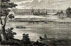
Since ancient times, people have settled on river banks. The Seine River in Paris was no exception, where a tribe of Gauls known as the Parisians appeared around the third century BC. It should be noted that an important trade waterway connecting the east with the Atlantic passed through it.
Origin of the name
There are several versions regarding the origin of the name of this reservoir. One of the most common is that the Seine River is named by the Latin word “Sequana”, which means “sacred river”. However, some historians argue that the name is of Gallic origin. They suggest that this is a modified name for the Yonne River, a tributary of which, according to the Gauls, was the Seine. In the lower reaches, on the territory of Normandy, this water stream was previously called “Rodo” - in honor of the plain of the same name.
general description
The Seine River stretches for 776 kilometers. It originates in Burgundy (a province in the eastern part of France), in the area of the Langres plateau, which rises 471 meters above sea level. It flows mainly through the northern French lowland, through the Paris Basin. In the immediate vicinity of Paris, it makes a lot of different winding turns. Not far from the city of Le Havre it flows into one of the bays of the English Channel. The largest tributary river of the Seine is the Oise. In addition to it, the Marne and Aube flow here on the right along the stream, and the Yonne on the left. The total area of the basin is almost 79 thousand km 2.

Be that as it may, the Seine is replenished mainly due to precipitation. The same can be said about other water bodies that are located in France. In particular, the period from November to March is characterized by the greatest rise in water levels. The slope of the Seine bed is just over 60 centimeters for every kilometer. In general, it can be characterized as a deep river with a stable level and a calm flow.
Role for the country
The Seine is now an important shipping route for France. Starting from the town of Troyes, the river has transport status, because from this place ships with a draft of up to 1.3 meters can ply downstream. Ships with a draft of up to 6.5 meters sail to the port of Rouen. From the latter, shipping to the capital has been established; ships with a draft of up to 3.2 meters can pass here. Due to numerous artificial canals, the Seine is connected to other rivers. It should be noted that there are a large number of ports located on its shores. The largest of them are concentrated in the cities of Paris, Rouen and Le Havre. The role of the river for the whole of France is so important that it is unofficially called the 21 districts of the capital (according to the officially approved administrative structure, there are 20 of them).

Geographical location
The Seine River on the map conventionally divides the French capital into two parts, crossing it from southeast to west in a kind of arc. The left bank is considered artistic and bohemian, while the right bank is considered a business center, where numerous administrative buildings, the royal residence of the Louvre, gardens, squares and many other buildings are located. The historical center of Paris, the Ile de la Cité, is also located on the river. Outside the city, this waterway carefully bends around the famous one and then flows towards the English Channel.

Bridges
The city on the Seine River is one of the most popular tourist centers in the world thanks to its numerous cultural sites. Without a doubt, these include local bridges. In total, there are 37 of them stretching across the Seine within Paris. Some of the most beautiful of them are considered to be Notre Damme, Petit and Louis Philippe, built several centuries ago. It should also be noted that on this river, or rather, at its mouth, there is the Normandy Bridge - one of the longest suspended structures of its kind on the planet. Its length is 2350 meters and its width is 23 meters.

Attractions on the Seine
The Seine River has many architectural monuments on its banks. Moving along the current on a boat, you can see the Louvre along with a complex of museums, the Bourbon Palace, the Invalides, as well as the Les Invalides, immortalized by Victor, built between the twelfth and fourteenth centuries. Tourists going down the river have a great opportunity to get a good look at the world-famous symbol of the city - the Eiffel Tower - on the left bank. It should be noted that traffic along the Seine is continuous. You can take a ride and admire the beautiful city using both small yachts and pleasure cruise ships. Unfortunately, this cannot but affect the condition of the river - the water here is heavily polluted.

A large number of interesting historical facts, legends and beliefs are associated with the Seine. In particular, it is believed that the ashes of Joan of Arc, who was burned in 1431, were scattered over her. In addition, the Seine River was so loved by the national French hero Napoleon Bonaparte that he dreamed of being buried on its banks. However, his will was never was fulfilled.
In 1910, there was a great Parisian flood, as a result of which the French capital was almost completely flooded. The cause of the disaster was a rise in the water level in the Seine in January by as much as six meters. Nothing like this has happened here since that time. In 1991, the Parisian banks of the river were included by UNESCO in the list of world heritage sites concentrated in Europe.
There are also unpleasant statistics associated with the Sena. The fact is that it is very popular among suicides, as well as criminals who throw the bodies of their victims into it.
SEINE RIVER - the most famous river in France
The total length is 776.6 km.
Drainage basin area - 79,000 km2
Height above sea level at the source - 446 meters above sea level
Average slope - 0.58 m / 1 km
Average water flow at the mouth – 563 m³/s
The Seine River is the fifth longest river in France . It is the largest river in northern France, flows entirely through the territory of France and is its symbolic river, due to the fact that many historical events are associated with it, especially from the life of the capital of France - the city of Paris, which is located on the banks of the Seine.
The total length of the Seine is 776.6 km. , the area of the river basin is 79 thousand sq. km. Seine originates in the Langres plateau, near the sources of the Meuse and Marne rivers, at an altitude of 446 meters above sea level, in the northwest of Seine-Saint-l'Abbey. Average slope of the Seine channel is only 0.57 m per 1 km. length of the riverbed.
 The name "Seine" comes from the Latin word Sequana, which, according to a common version, means "sacred river". There is a version that the name Sicauna is related to the name of the Saône River (France). Some scholars have hypothesized that Sequana is a Latinized version of the Gaulish Issicauna Lower-Icauna, the Gaulish name for a river. According to their assumption, the ancient Gauls considered the Seine a tributary of the Yonne, because. at the confluence of the Yonne and the Seine, the former is much larger.
In its lower reaches, in Normandy, the Seine was known as Rodo, or Roto. This is a Celtic name for the river, related to the name of the Rhone River. Both names are related to the name Rouen, which the Gauls called Rotomagos, which meant the plain of Roto.
The Seine is conventionally divided into five parts (from source downstream):
- Little Seine
, from the source to Montero-Fol-Yonne (merger with);
- Haute Seine
- Parisian Seine
;
- Lower Seine
, from Paris to Rouen;
- Seine of the sea
, from Rouen to the English Channel.
Coming down from the plateau Seine It carries its waters across the Paris Basin mainly from the southeast to the northwest. The upper course of the Seine River crosses the Chatillon plateau. Here the river's descent becomes weak. The river then crosses the Tonneroi bank, the Barrois bank. Flowing into Champagne beyond Bar-sur-Seine, near Troyes, the Seine forms numerous branches.
Given enough calm nature of the flow of the Seine River (the average slope is only 0.58 m per 1 km) - this is one of the most convenient rivers in Europe for navigation. Navigation on the Seine carried out over the last more than 500 km.
 The Seine flows into the English Channel
, through the creek de Rouen, near the city of Le Havre, where the width of the channel is about 800 meters, and Seine water flow
here it is about 563 cubic meters per second.
The Seine flows into the English Channel
, through the creek de Rouen, near the city of Le Havre, where the width of the channel is about 800 meters, and Seine water flow
here it is about 563 cubic meters per second.
The Seine is the most famous river in France , largely due to the fact that the capital of France, Paris, is located on its banks, within which there are 37 bridges across the Seine. Most of them go far back into the history of Medieval Europe. The most striking examples of such bridges are the Louis-Philippe Bridge and the Pont Neuf (built in 1607). In addition, approximately 30% of the French population currently lives in the Seine drainage basin. This is the most densely populated region of the country.
Interesting historical facts about the Seine:
According to legend, after Joan of Arc was burned on fire in 1431, her ashes were scattered over the Seine;
- Napoleon I Bonaparte, who died in 1821, wanted to be buried on the banks of the Seine, but his will was not fulfilled;
- In January 1910, the water level in the Seine rose 6 m above normal, flooding almost the entire city. According to historical records, the Great Paris Flood of 1910 was the worst the city had seen since 1658, when water levels were several centimeters higher. By the way, until now there have been no more such grandiose floods in Paris;
- The Seine River was one of the main goals that were set when achieving Operation Overlord in 1944;
- In 1991, the banks of the Seine River in Paris - Rive Gauche and Rive Droite were added by UNESCO to the list of world heritage sites in Europe;
- The Seine was a popular place for suicides and criminals who dumped the bodies of their victims here. In 2007, 55 corpses were recovered from the river; in February 2008, the body of supermodel Katoucha Nian was recovered from the same place.
More information about the rivers of France:

Despite the fact that in the Seine basin There is a relatively stable level of precipitation throughout the year - floods also occur here. There are two types of water overflow from the banks of the Seine : flash floods that occur after heavy rainfall in the "upper" Seine basin, and long-lasting floods in the Seine valleys further downstream that occur after long periods of rain.
Flood period in the Seine basin It happens mainly at the end of winter, when the fallen snow begins to melt at a rapid pace and heavy rains begin to fall. In this case, the level of the Seine and its tributaries increases noticeably, and the total volume of water in its channel increases several times. For example, average water flow in the riverbed of the Seine in the Paris region it is 328 m3/s, but during periods of major floods this figure increases several times - up to 1,600 m3/s.

Stormy rapids in the upper reaches of the Seine
Given the relatively small slope of the river, an increase in its level by several meters immediately affects the state of water levels in the tributaries of the Seine. This is primarily reflected in large tributaries Seine , which flow into it in the lower and middle reaches: Oise, Er, Marne. This pattern does not occur in the upper tributaries of the Seine. An inverse relationship is observed here, when a sharp increase in water in the tributaries (, Ob, etc.) entails an increase in the water level in the Seine.
To regulate the water level in the Seine basin , as well as to minimize the possible adverse consequences of floods, in the period from 1960 to 1990, four large reservoirs were built on the Seine and its tributaries on the Seine (Lake Orien), on the Marne (Lake Der Chantecoq), on the Aube (Lake Amance and reservoir du Temple), on the Yonne (Lake Panaciere). These lakes, which together have water reserves of more than 800 million cubic meters, make it possible not only to prevent sudden floods and floods in the Seine basin, but also to ensure in this case a minimum low water flow, which contributes to flood management.
Hydrological data of water flow in the Seine (hydrological station H7900010 in Poissy at an altitude of 17 m above sea level) for the period 1975-2010.

Seine River Basin , with an area of 79,000 km2, lies almost entirely within the Paris Basin, which geologically represents an accumulation of sedimentary rocks from an ancient sea. The relief in the Seine basin usually does not rise above 300 meters above sea level, with the exception of its southeastern edge, where the Morvan massif rises (up to 900 meters). Low average height over entire area Seine catchment explains the slight gradient of rivers (0.01 to 0.03 m per 100 m) that flow west through the eastern part of the Paris Basin.
 Hydrographic points delimiting the Seine catchment boundary
:
Hydrographic points delimiting the Seine catchment boundary
:
A point on the Langres plateau in the commune of Val-de-Meuse (47°56"29 N, 5°30"20 E, altitude: 453 m) south of the remains of the Roman road Bourbonne-les-Bains, - delimits the Seine basin from the Rhone (Saône River) and Meuse basin;
Point in Cote d'Or in the city of Meilly-sur-Rouvre (water tower on the Vachère city road (47 ° 12 "16 N, 4 ° 33 "07" E, altitude: 440 m above level sea) - delimits the Seine basin from the Rhone-et-Loire basin.
When approaching the territory of the Ile-de-France region, Seine merges with the Aube tributary in the north of Romilly-sur-Seine. After merging with The Seine becomes a great navigable artery . Below it receives the waters of such large tributaries as the Aisne (355.9 km), Marne (514 km), Oise (341.1 km), as well as several dozen smaller rivers and rivulets. In Paris, the Seine merges with the tributaries Essonne, Orge, Yerres, and Marne (near Paris).
MAIN RIBUTARIES OF THE SEINE

Upper Seine is a section of the river from its source to its confluence in the commune of Montreau-Fault-Yonne.
Located in the commune of Source-Seine, on the Langres plateau, at an altitude of 446 meters above sea level. Previously, since 1864, the territory source of the Seine was owned by the city of Paris. In 1865, an artificial cave was built here, through which the source of the river was directed, and a statue of a nymph symbolizing the river was erected near the cave. However, over time, the capital lost interest in the area, and the site was returned to the jurisdiction of the Burgundy region.

Already 2 km from the source, on the Seine, which in this place is a small stream, there is a small reservoir - the Grillande pond (Étang de Grillande). The same pond (Chateau Pond (Étang du Chateau)) is equipped with a dam another 7.5 km along the Seine. Here, in the upper reaches, the Seine heads almost strictly in a northerly direction. On the way to the town of Châtillon-sur-Seine, it receives the waters of several small rivers and streams. The largest of them are the right tributaries Verreri, Revenson, Brevon. In Châtillon-sur-Seine the Seine already takes on the characteristics of a river. Here, full-fledged bridges are thrown across it, and the riverbed in some places is reinforced with concrete structures.
Below Chatillon-sur-Seine, slope of the Seine falls significantly, and the river, having entered the plain of the Paris Basin, begins to periodically divide into several branches. Due to the flat topography with a uniform base of sedimentary rocks, the Seine practically does not change direction, only slightly moving to the northwest. Near the commune of Merrey-sur-Arce, the Seine receives the waters of the first fairly large tributary - the Ours River, the length of which reaches almost 100 km (99.9).
From the commune of Bourguignons The Seine finally takes a northwest direction and over the next 100 km, up to the city of Marcilly-sur-Seine, it does not change. Here the Seine receives another large right tributary - the Aube River (length 248 km, basin area 3,600 km2), which almost doubles the size of the Seine and its water flow.

After Marcilla-sur-Seine, the Seine sharply changes direction to the west, and then to the southwest. After 70 km. your way in this direction, near the town of Montreau-Fault-Yonne, The Seine meets the main left tributary - the river (292.3 km, basin area - 10,836 km2). Confluence of the Seine and the Yonne doubles its size. sometimes it can even be considered the main river, and the Seine its tributary, given the seasonal fluctuations in their flow.
According to generally accepted practice, when rivers merge, the stream that has the highest annual flow of water at the confluence gives its name to the second stream. According to this definition, the Seine would become a tributary, and not vice versa, because at their confluence at Montreaux-Fot-Yonne, the Yonne has a water flow of 93 m3/s with a drainage basin of over 10,800 km2, while The hay has a water flow in the area of 80 m3/s and a catchment area of 10,300 km2. The same situation occurs upstream of the Seine, at its confluence with the Aube River. The area of the Aube River basin is 4,700 km2, and the water flow at its confluence with the Seine is 41 m3/s, while the area of the Seine basin at this point does not exceed 4,000 km2, with a water flow of only 33 m3/s . After merger with Sena takes on the features of a large full-flowing river with a channel width of over 100 meters and passes into the “middle current”.
More about Sena:
Middle Seine runs on the section from the city of Montreaux-Fot-Yon to Paris. In this area, the Seine is a navigable river, capable of supporting the navigation of small passenger and cargo ships.
Almost immediately outside the town of Montreaux-Fot-Yon The Seine takes a northwest direction and after 35 km. comes to the city of Melun. Here, three bridges were built on the Seine, and on the shore of the island there was a pier for servicing transport ships. To ensure navigation on the Seine in the middle reaches, several locks are equipped. The first of them is found in the commune of Maison Rouge. Then, downstream, the same locks are equipped in several more places (Champagne-sur-Seine, La Cavé, Boissise-le-Roi, La Demi- Lune (La Demi-Lune), Evry (Évry), etc.).

Seine in the suburbs of Paris
In the suburbs of Paris, Ivry-sur-Seine The Seine receives the waters of a large right tributary - the Marne River (514 km, basin area - 12,920 km2). Here, the width of the Seine channel reaches 150-160 meters, and the banks are dotted with berths for civilian ships and concrete fortifications, in order to prevent the Seine from uncontrolled spilling and overflowing its banks.
In the Seine area of Paris starts to loop. Having a general course to the northwest, the river carved its bed along a very intricate trajectory, describing circles with a diameter of up to 5 km.
Section of the Seine within Paris - the most navigable based on the number of ships passing along the river per unit of time. In addition to transport ships and barges, regular passenger ships and pleasure ships ply here. The entire embankment of the Seine here is a concrete pier.
Below Paris, a few kilometers downstream, The Seine receives the waters of the right tributary - the Oise River (length - 341 km, basin area 16,667 km2). After the Oise flows into the Seine, the channel of the latter reaches a width of about 215 m, and the Seine enters the “lower flow” stage.
After the right tributary, the Oise River, flows into the Seine, Seine enters the last sub-watershed and becomes lower Seine .
Here Seine continues its direction to the northwest along a winding channel with a slight slope. In this area, the Seine acts as a major transport artery with the corresponding infrastructure. In many places on the banks of the lower Seine there are transport and cargo terminals to accommodate fairly large ships. Here the Seine channel is constantly monitored and its proper depth is ensured for the passage of ships with increased displacement.
On the way to Rouen Sena accepts Another large right tributary is the Epte River (length 113 km), as a result of which the width of its channel near the city of Vernon reaches 220 meters. A little further downstream, the left tributary, the Er River, flows into the Seine (length - 228.7 km, basin area - 6,017 km).

In Rouen the Seine becomes accessible for navigation by large sea vessels, since measures are being taken to deepen its channel to 10 meters. Because of this, despite the constant arrival of new volumes of water with tributaries, the width of the Seine channel here practically does not change. In Rouen on the Seine, the terminals of the Grand Seaport are located, where sea vessels with a length of up to 280 m and a displacement of up to 150,000 tons enter.
The last 120 km. to the mouth - Seine passes with a very slight slope. The influence of sea tides is especially felt here. This section of the Seine is also called "Sea Seine" . Sea tides can raise the water level of the Seine up to where the River Eure flows into it. Until the 1960s, tidal surges of up to 4 m could be observed in this section of the Seine. However, this phenomenon has virtually disappeared as a result of changes made to the river (dredging, containment and modification of the estuary).
At the mouth of the Seine overflows, turning into a kind of narrow bay - the Rouen Creek (Crique de Rouen). The width of the Seine in the area of the Normandy Bridge is about 1.4 km, and at the exit to the sea, near the city of Le Havre - 6.5 km.
 |
 |
In the river navigation service, the Seine is divided into several sections :
- Little Seine
, from the source to Montero-Fol-Yonne (confluence with the Yonne);
- Haute Seine
, from Montero-Fol-Yonne to Paris;
- Parisian Seine
;
- Lower Seine
, from Paris to Rouen;
- Seine of the sea
, from Rouen to the English Channel.
The Seine is navigable along much of its length . Responsibility for ensuring navigation on the Seine belongs to the Voies de France shipping service up to the Boieldieu bridge in Rouen, as well as to the navigation service on the Seine upstream from the commune d "Amfreville-sous-les-Monts. The activities of this navigation service of the Seine also extend to its main tributaries ( Oise, Marne, ), and sometimes to associated canals (the Haute-Seine canal in Mary-sur-Seine, for example). On the other hand, this does not include Parisian canals (Canal de l "Ourcq, Canal Saint-Denis and Canal Saint- Martin), administered by the city of Paris.

Section of the Seine Marine , that is, from the mouth of the river to the Guillaume-les-Conquinteres bridge in Rouen, is accessible for navigation by ocean-going ships (up to 280 m in length and with a displacement of up to 150,000 tons). On this part of the river, about 120 km long, there are only three bridges (Pont de Normandy, Pont Tancarville and Pont Broughtonne), which provide a span height of over 50 meters from the water level of the Seine. The river bed here is constantly cleared to ensure the passage of ships with a draft of up to 10 meters. The port facilities on this section of the Seine are operated by the Grand Maritime Port of Rouen, which specializes in the transport of grain crops, fertilizers and petroleum products. The port infrastructure facilities are located along the river banks for 120 km from the Rouen agglomeration to Honfleur.
The navigation section of the "Lower Seine" from Rouen to Paris was already in use in the 19th century . During this period, it was actively developed to ensure adequate water levels and ensure the possibility of wide trade navigation up to the city of Paris. Seven sluice dams located in Poses-Amfreville-sous-les-Monts, Notre-Dame-de-la-Garenne, Eure department , Méricourt, Andrésy, Bougival, Chatou (Yvelines department) and Suresnes (Hauts-de-Seine department) allow navigation of self-propelled barges (with a carrying capacity of up to 350 tons), "self-propelled Freycinet boats" , up to 38.5 meters long, self-propelled river barges with a carrying capacity of 800 to 1350 tons of cargo, a length of 48 to 70 meters, columns of barges (with a total carrying capacity of 3,000 to 10,000 tons of cargo) and river vessels (with a carrying capacity of up to 4,000 tons) . These ships and barges transport, among other things, containers, cars, petroleum products, cement, etc.
Port facilities located on Seine in the Ile-de-France region, belong to Paris Autonomous Port , the first French river port. The main port facilities for cargo transport are located in Limay (Yvelines) and Gennevilles (Hauts-de-Seine). As part of the project in the city of Achères, Yvelines, the possibility of constructing a multimodal logistics complex combining waterway, highway and railway is being considered.

The "Paris Seine" is also characterized by wide river navigation . Passenger river transportation is developed here, mainly tourist (boat). Attempts are being made to organize regular daily passenger services (Batobus). River buses run regularly between the Eiffel Tower and the Jardin des Plantes; however, this service seems to have attracted more tourists than Parisians, creating awkward competition for the boats. Passenger service is also organized between the Austerlitz station and the commune of Maisons-Alfort on the Marne.
On the section of the Upper Seine A large-scale project for organizing river transport between the Seine and Scheldt basins was implemented. By widening the Saint-Quentin Canal, built in 1810, and the Canal du Nord, 1960, the river ports of Normandy and Ile-de-France were connected to the navigable river network of northern France and Benelux countries, ensuring the passage of vessels with a carrying capacity of class Vb (displacement 3,200 - 6,000 tons).
"Little Seine" not suitable for navigation.
More details:
Many people know where the Seine River is located, but the history of the water flow will not be described. Seine is attractive because it is located on Paris. The city was built around a water trade and transport route. The early tribes of Paris were attacked here and driven off by the Romans. What was conquered then turned into what was especially desired. Seine was previously called Sequana. It continues to be the main trade route.
The length of the Seine River is 776 km. Basin - 78.65 thousand km 2. The channel goes to the northwest. The source starts in Burgundy (a historically known zone in the eastern part of France), height - 471 m. The greatest European river, the network of which serves almost entirely the inland water transport of the state. Where does the Seine River flow? To the English Channel.
½ of the water used by Parisians comes from the Seine. You need to forget about this fact when you see where the Seine River flows, or garcon will give water.
Today on the embankments you can see sunbathers, tourists taking photos of the Seine River, cyclists, mothers walking with babies in strollers, and athletes. The embankments roughly divide the city in half: into a highway and paths for pedestrians and cyclists. The area was called "Paris Beach". They equip the resting place with palm trees, sun loungers, and tons of sand.
On the coast there are luxurious restaurants, noisy discos, and reasonably priced bars. Ordinary benches will delight travelers who want to fill themselves with a piece of bread and cheese while looking at the Seine. Floating households can be seen from the right bank.


The embankment walls made of stone are the language of the Seine's past. If desired, it is possible to examine different water levels that appeared after floods, huge iron rings that tie barges, a cast iron grate or a door to an underground passage, an old sewer system, and entrances to the subway. The embankments are protected by UNESCO and are World Heritage Sites.
River bridges
The Seine River in France is partially covered by 32 bridges. The oldest is Pont Neuf, seen in the works of masters of words and brushes.

The structure can be seen in films of the last century. There is an attractive small island near the bridge, with pleasure boats mooring to it. In the warm season, it is pleasant to sit on a bench or take a sunbath on the sloping embankment. The road leads to the equestrian statue of Henri the Fifth, then you need to go down the steps to the docks. The view will appeal to those who like to watch drifting boats.

Pont Des Arts is a metal bridge for pedestrians only. From here you have a magnificent view of the French capital. Some bring drinks and food, others bring guitars, and it turns out to be a celebration.
The estuary is crossed by the long Normandy suspension bridge, 2350 m long. The central span is 935 m. The width is 23 m. The traffic is four-lane. Started working in 1995.

Information for tourists
Relatively recently, the river was considered unsuitable for swimming and fishing, but thanks to the efforts of environmentalists, the Seine was cleared of sewage. Now Atlantic salmon is caught here, which is a positive trend, but no one has canceled the presence of increased concentrations of heavy metals in the water. This is not an obstacle to river travel; France offers many other privileges for spending time on the beach. In the Parisian environs, during the summer heat, artificial beaches are made from imported sand, here you are allowed to sunbathe and have fun (namely, have fun, don’t swim).
At the mouth of the Seine there is the botanical garden of Honfleur. Butterflies, exotic birds, and flora will delight you. You can enter with a ticket costing up to 9 €. The Buccle de la Seine Normand protected area is located near the exit from Le Havre; there are zoological and entertainment parks on the Rouen borders.

In addition to river cruises, vacationers are invited to boarding houses and campsites located outside industrial zones. There are establishments on every kilometer (you just have to find the Seine River on the map and see for yourself). Bistros, gas stations, and car rentals are nearby. There are yacht clubs in the seaside part. In the capital, you can temporarily use (not for free) a barge standing on the embankment to relax, like in a hotel, on a mini-terrace. This pleasure costs approximately 200 euros per day (if up to 5 people are relaxing).
There are several versions about the origin of the name of the Seine River. However, according to the most popular of them, it is related to the Latin word "secuana", meaning "sacred water". Presumably, this is what the first settlers called the trade waterway, the waters of which originate in the lands of Burgundy, namely in the southern part of the Langres plateau, and the appearance of the first tribes on its banks dates back to the 3rd century BC.
Having a length of 776 km, the Seine crosses the cities of Le Havre, Paris, Poissy, Rouen, where the largest river ports are located, and completes its journey connecting with the waters of the English Channel. The river has right tributaries - Oise, Marne, Aube and several left ones - Yonne, Er. But the main source of nutrition for the Seine is precipitation, which ensures regular replenishment of water resources.
It is interesting that the Seine, for the convenience of organizing navigation along the river, was divided into several parts. Namely, the section of the river from the source to the confluence with the left tributary of the Yonne is usually called the Little Seine. The next part to Paris is the Upper Seine, and then follows a section with the telling name Paris Seine, which is replaced by the Lower Seine, the part from Paris and up to Rouen. From Rouen to the English Channel lies the final section of the river - the Seine of the Sea. Each of these parts contributes to the formation of the overall image of the Seine, making it romantic, intricate and unique.
The most French river is the Seine
About a dozen large rivers more than 300 km long and at least a hundred smaller rivers flow through the territory of France. However, none of them has gained such popularity as the Seine River, which has become not just a symbol of Paris, but of the whole of France. Perhaps it could not have been otherwise. After all, it was the Seine that divided the French capital into a free bohemian left bank and an important business right bank. The picturesque landscapes of its banks inspired Manet, Renoir, Picasso, Matisse...
The special charm of the Seine lies in the presence of many bridges, each of which is unique both in its history and in its design. For example, the Pont Neuf bridge. Its construction began in 1578 by Henry III of Valois and for several centuries it has been serving the Parisians, bearing the proud title of the oldest bridge in Paris. And the “youngest” bridge, named after Charles de Gaulle, was opened to traffic in 1996 in order to relieve congestion on roads with heavy traffic. In total, 32 bridges span the Seine in Paris alone.
The Seine, dividing Paris into two banks, allowed each of them to become unique. The left bank, freer and more tolerant, has always been the center of bohemian and cultural life. The Eiffel Tower and the Rodin Museum, the Parisian Catacombs and the famous Odeon Theater, the churches of Saint-Severin and Saint-Sulpice are located here. The right bank, once the territory of the “cream of society,” has now retained the right to be called the business center of Paris. But he is interested not only in financial transactions. It is here that the Champs Elysees, the Arc de Triomphe, the Louvre, Montmartre, the Picasso Museum, the Moulin Rouge and much more are located.
When visiting Paris, there is no question of which coast to choose to visit. After all, each of them, reflected in the serenely flowing waters of the Seine, is able to give special impressions that remain in the memory forever.
Artur Staszewski / flickr.com James Whitesmith / flickr.com Thomas Claveirole / flickr.com Panoramas / flickr.com Jean-François Gornet / flickr.com dany13 / flickr.com Joe deSousa / flickr.com Excursion boat on the Seine (Joe deSousa / flickr.com) Joe deSousa / flickr.com Joe deSousa / flickr.com Dennis Jarvis / flickr.com Pleasure Boat Marina, Paris (Joe deSousa / flickr.com) stanze / flickr.com Curtis MacNewton / flickr.com Falcon® Photography / flickr.com Falcon® Photography / flickr.com Joe deSousa / flickr.com
Since ancient times, people have inhabited the banks of rivers. Traditions were not violated on the banks of the Seine, located in Paris, where Gallic tribes settled around the middle of the third century BC. It is worth noting that one of the main trade waterways passed through the river.
In the course of studying the origin of the name of this water artery, two options are distinguished. The most common one is that it was named in Latin "Sequana", which means "noble river".
However, a small number of researchers believe that the name has a Gallic origin. Scientists have suggested that this is a derivative of the name of the Yonne River, since the peoples who inhabited the region thought that the Seine was a tributary of the latter.
general description
The length of the Seine is 775 km. The source of the Seine is in the Burgundian lands (a region in the east of the country), in the vicinity of the Langres plateau, which is 470 meters above the surface of the sea.

It stretches mainly along the North French Lowland, through the Paris Basin. Closer to the capital, it makes many different winding turns.
Near the village of Le Havre it flows into one of the backwaters of the English Channel.
The largest watercourse of the Seine is the Oise. In addition to it, the Marne and the Aube flow in from the right along the riverbed, and the Yona from the left. The total area of the water surface is almost 80 thousand km.
The Seine River is filled mainly due to air emissions.
From mid-autumn to mid-spring, it is characterized by a rise in water levels, but in general the Seine is high-water with a constant rate and quiet movement of water masses.
Role for the country
Currently, the Seine River is the central shipping artery of France. From the city of Troyes, the Seine River is considered a transport river, since ships with a draft of no more than 1.3 meters can move from this settlement.
Vessels with a dive of up to 7 meters move to the harbor of Rouen. From the latter there is a route to the capital; ships up to 3.3 meters can sail there.
There are many ports along the banks of the Seine. The largest are in the cities of Paris, Le Havre and Rouen. The importance of this waterway for France is very great.
Among the population, the Senya River has the unofficial name “21 districts of Paris” (according to the administrative structure there are 20 of them).

Pleasure Boat Marina, Paris (Joe deSousa / flickr.com)
Geographical features
The Seine River divides Paris into two halves, cutting it into a crescent. The left edge is usually considered to be the business core, where representative buildings are located.
The oldest place in Paris, the Ile de la Cité, is also located here. Outside the city, the Seine bends around the famous Bois de Boulogne and then flows towards the English Channel.
Bridges over the Seine
The cultural buildings that are located along the coast are very popular among travelers all over the world due to their authenticity. This list includes nearby river crossings.
Within the city limits across the Seine there are about 37 of them, the most popular of which are: Notre Damme, Petit and Louis Philippe, built several centuries ago. The Normandy Bridge, a long-lasting architectural legacy, will also be stretched across the river.
The Seine River in Paris - what to see?
There is a variety of architecture along the banks of the river. Moving along the riverbed by transport, you can look at the Louvre, the Bourbon Castle, various museums, as well as the Parisian Notre Dame Cathedral, built in the 14th century, and of course the Eiffel Tower. You can travel around and admire the beauty of the city on small boats or on a pleasure boat.

View of the Eiffel Tower from the Seine River (Thomas Claveirole / flickr.com)
Unusual facts about the river
Many unusual events from the past are intertwined with the Seine. It is generally accepted that the ashes of Joan of Arc, who was burned in the Middle Ages, were scattered over the Seine. In addition, the well-known conqueror Napoleon, who dreamed of being buried on the banks of the Seine, spoke flatteringly about the river, but his dreams were not destined to come true.
In 1910 there was a huge flood, as a result of which Paris was flooded. Similar cases have not happened since then. The banks of the river located in the capital of France in 1991 were recorded by UNESCO in the list of world heritage sites located in the territory of the Old World.